Go  | New  | Find  | Notify  | Tools  | Reply  |  |
| Member |
For a flight from Denver to Champagne/ Urbana. On many different aircraft , are there six different altitudes designated for six types of aircraft? One for rotor craft, Another for single engines, another for multi engine fixed wing Turboprops, another for jet aircraft, Another for multi engine jets? Safety, Situational Awareness and proficiency. Neck Ties, Hats and ammo brass, Never ,ever touch'em w/o asking first | ||
|
| Member |
Short answer: no. Altitudes (or flight levels(FL) when 18000 feet and above) are generally odd going east and even going west bound. Visual flight rule (VFR) traffic generally fly at an altitude plus or minus 500 feet. ie 7500 going east or 4500 going west. VFR traffic is not allowed above 17500 in controlled airspace (generally anywhere in CONUS). IFR traffic would fly at 9000 going east or 10000 going west, just for example. This theoretically gives at least 500 foot vertical separation for all traffic. Once you get into the FLs the concept remains the same. FL310 for east and FL320 for west. FLs are based off a standard barometric altimeter setting (29.92) but fairly coincide with the altitude ie FL320 is roughly 32000 feet. These are all above sea level altitudes. There are preferred routings and FLs in a lot of busy airspace, but otherwise you fly the optimal altitude for your type of aircraft if you can get it from Air Traffic Control. These are the general rules for altitude selection, regardless of the type of aircraft or number of engines. | |||
|
| Member |
To add to what Roy said, generally a pilot will pick the altitude that's most advantageous for their mission. A helicopter doing power line inspections will only be flying a few feet off the ground where they have good visibility of what they're inspecting. A GA pilot in a Cessna will pick an altitude that gives them obstacle clearance, safety margin if they lose an engine, and the most favorable winds they can reach. A passenger jet will be looking for an altitude that balances safety and efficiency (jets become considerably more efficient at higher altitudes). "The people hate the lizards and the lizards rule the people." "Odd," said Arthur, "I thought you said it was a democracy." "I did," said Ford, "it is." "So," said Arthur, hoping he wasn't sounding ridiculously obtuse, "why don't the people get rid of the lizards?" "It honestly doesn't occur to them. They've all got the vote, so they all pretty much assume that the government they've voted in more or less approximates the government they want." "You mean they actually vote for the lizards." "Oh yes," said Ford with a shrug, "of course." "But," said Arthur, going for the big one again, "why?" "Because if they didn't vote for a lizard, then the wrong lizard might get in." | |||
|
| Dances With Tornados |
I know little, I'm curious, maybe you guys can explain the "routing" pilots and ATC people use to navigate from here to there. I think they're called waypoints or something like that, they all have some sort of names, I guess they're sort of aerial highways to keep planes separated and getting to where they need to go. Thanks. . | |||
|
| Member |
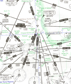
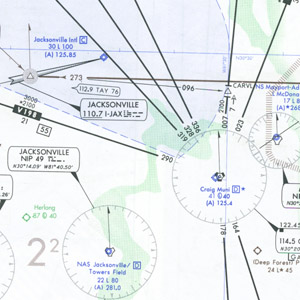
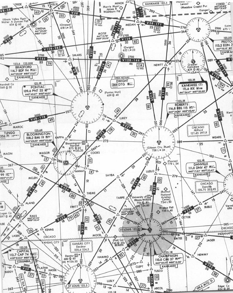
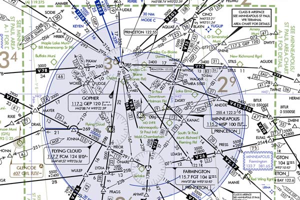
^^^^^ In a flight plan that is filed with ATC, you will follow "Airways" to navigate from "fix-to-fix" or from "waypoint-to-waypoint". A fix, when navigating with basic Radio Navigation, e.g., a VOR, is an established point along the airway defined by a specific distance from the VOR navigation aid you're using. A waypoint, on the other hand, is defined by Latitude/Longitude coordinates and is used when navigating by GPS. In the VFR Chart depicted below, CARRO (in the lower left corner) is a FIX on V27 and is 24 miles from the SEA Vortac, indicated by '24' above the box containing V27. An Airway may be designated as a VFR airway for aircraft flying under Visual Flight Rules (at and below 17,500') or IFR or "J(et) Airway" (and others, like a Q Airway/Route) when operating under Instrument Flight Rules at and above 18,000. Often times, a VFR airway and IFR airway will have the same course; what you're following and the route you file with ATC depends on the aforementioned altitudes. Sometimes a Vxx Airway (what we call "Victor Airways") may be used for both VFR and IFR routing. And to be clear, it doesn't have to be a bad weather day for a flight to file and operate under Instrument Flight Rules. I have often flown General Aviation flights under an Instrument Flight Plan and Clearance with blue skies and great visibility, or CAVU - Ceiling and Visibility Unlimited. I chose to file under IFR because ATC has to then accept me into their airspeace without delay, for the most part. Take note, however, that the pilot MUST possess an Instrument Rating on his Pilot Certificate in order to file a flight plan under IFR. Being filed on a VFR flight plan or an IFR flight plan is really an indicator to ATC of who gets priority handling if aircraft under both flight plans enter their airspace. Typically, flights filed under an IFR flight plan will get priority handling. If the Controller is saturated with IFR traffic, he/she can instruct the VFR pilot to remain clear of their airspace, and the pilot MUST comply. Here is an example of a VFR chart that would be used for Visual Flight Rules. Note the airway "V27". The pilot would utilize the Seattle VOR to navigate on that airway and be flying the 230 degree radial (or bearing) from that VOR to maintain a track on V27, correcting for the wind.  Here are a couple of examples of an IFR chart. Notice there is MUCH less ground detail versus the VFR chart, because it's assumed the flight will be at a MUCH higher altitude (18,000 feet minimum) and would not be in a position to notice detailed landmarks as depicted on the VFR chart.    This one gets complicated....  "If you’re a leader, you lead the way. Not just on the easy ones; you take the tough ones too…” – MAJ Richard D. Winters (1918-2011), E Company, 2nd Battalion, 506th Parachute Infantry Regiment, 101st Airborne "Woe to those who call evil good, and good evil... Therefore, as tongues of fire lick up straw and as dry grass sinks down in the flames, so their roots will decay and their flowers blow away like dust; for they have rejected the law of the Lord Almighty and spurned the word of the Holy One of Israel." - Isaiah 5:20,24 | |||
|
אַרְיֵה |
erj_pilot gives a good explanation. I wanted to throw in a piece of trivia, that will catch a lot of pilots. In discussing V27, the 230° radial is equated to the bearing from the VOR (VORTAC, actually). The trivia thing is, the bearing and radial might or might not be the same. Fun fact: We think of the radial as the magnetic bearing from the VOR (or VORTAC). This was true at the time that the VOR(TAC) was commissioned. However, the magnetic north pole is not in a fixed position. It drifts, with time, and the VOR(TAC)'s orientation is not changed to stay in sync with magnetic north, so there might be a degree or so difference between radial and bearing. הרחפת שלי מלאה בצלופחים | |||
|
| Age Quod Agis |
I knew that magnetic compass deviation thing because I have done ground school with V-Tail. Don't know much else... "I vowed to myself to fight against evil more completely and more wholeheartedly than I ever did before. . . . That’s the only way to pay back part of that vast debt, to live up to and try to fulfill that tremendous obligation." Alfred Hornik, Sunday, December 2, 1945 to his family, on his continuing duty to others for surviving WW II. | |||
|
אַרְיֵה |
Deviation is compass error due to influences in the installation. Magnetic stuff in the aircraft Variation is due to the difference in geographic location between North Pole (on the axis of earth's rotation) and magnetic north. Remember, "True Virgins Make Dull Company" הרחפת שלי מלאה בצלופחים | |||
|
Probably on a trip |
This is why every so often they re-number runways because the drift is so much that they are no longer magnetically aligned with when they were placed. The runways did not move - the magnetic drift did. This and no other is the root from which a tyrant springs; when he first appears above ground he is a protector. Plato | |||
|
| Rumors of my death are greatly exaggerated  |
Excellent answers from those above. If you do happen to have any other specific questions, feel free to pm me. I was an en route ATCS for 29 years and I also have my ATP and flight instructor privileges. The airspace system we have in the USA is very safe, very complex, and very dynamic. Safe and proficient pilots never stop learning. "Someday I hope to be half the man my bird-dog thinks I am." looking forward to 4 years of TRUMP! | |||
|
אַרְיֵה |
And all along, I thought that they were shifting the runway orientation for noise abatement. Who knew? הרחפת שלי מלאה בצלופחים | |||
|
| No More Mr. Nice Guy |
I'm pretty sure I learned that in instrument ground school about a million years ago, but had forgotten it. Cool trivia! | |||
|
| Powered by Social Strata |
| Please Wait. Your request is being processed... |
|
© SIGforum 2025